
Transform Roadway Management with GIS Matching AI
Urban SDK delivers next-generation roadway insights by combining advanced AI, rich visual data, and seamless geospatial integration to State systems. Empowering your agency to inspect infrastructure faster, analyze more deeply, and integrate state agency databases that improve safety, reduce costs, and modernize infrastructure management.


AI-Powered Roadway Intelligence for Modern Transportation Agencies
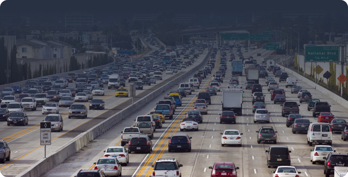
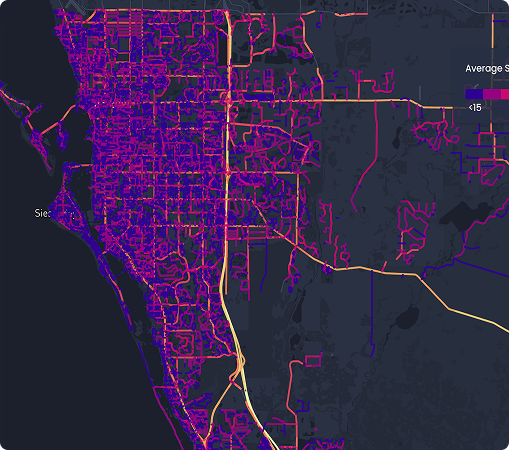
Aging infrastructure, tightening budgets, and rising safety expectations require a smarter approach. Urban SDK provides a unified, automated roadway intelligence platform—leveraging imagery from satellite imagery, dash cam, Google Street View, and LiDAR integrations—to merge existing State GIS data to deliver the most complete and current view of your network.

High-Accuracy Roadway Data
Access up-to-date conditions, asset inventory, location referencing, and historical context for every road in your network.

Reduce Inspection Costs
Automate manual fieldwork, reduce driven miles, and prioritize maintenance schedules to dramatically reduce operational spend.

Integrate with State Systems
Unify existing State GIS data through smarter reference matching for more reliable administration and advanced modeling.
How It Works

Capture
Capture expansive roadway visuals using satellite imagery, dash cam, Google Street View, and LiDAR — creating a rich, always-current visual record of your entire network.
.png)
Detect
Urban SDK’s AI automatically measures facilities and intersections, detects conditions, assets, safety hazards, markings and matches to precise locations to expedite mapping.
.png)
Standardize
Information flows directly into your systems, databases to match with administrative and operational data requirements via an intuitive GIS platform, Open APIs, or ESRI services.
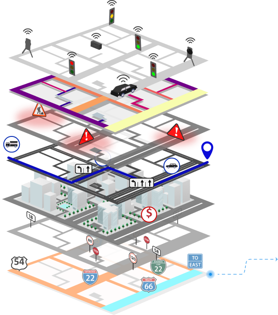
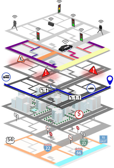
What Urban SDK Detects
.svg)
Roadway Features
Road width, number of lanes, median width, median length.
.png)
.svg)
Complete Streets Features
Sidewalk width, sidewalk separation width, crosswalk width, crosswalk length.

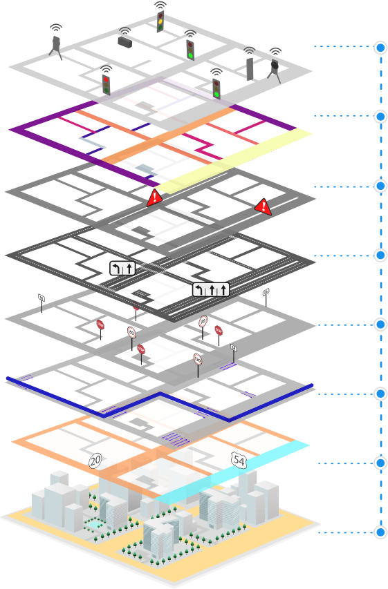
What Urban SDK Matches


01
02
03
04
05
06
07
.png)
01
02
03
04
05
06
07
Satellite Imagery + Urban SDK AI
Urban SDK harnesses high-resolution satellite and aerial imagery and AI-driven detection to deliver continuously updated right-of-way data—no fieldwork required. Each data point is precisely aligned to Urban SDK’s linear reference system (LRS), enabling seamless correlation with traffic speed, volume, and other operational metrics.

With Satellite Imagery, you can:
- Maintain a census of your right-of-way assets and geometry
- Build a historical baseline of right-of-way geometry to monitor changes and inform long-term planning
- Accelerate disaster assessment with before/after comparisons
.png)
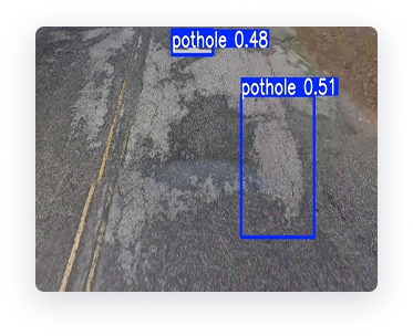
Fleet Vehicle Dash Cam + Urban SDK AI
Urban SDK integrates directly with dash cameras and mobile devices, to turn fleet vehicles into unmatched roadway visibility and historical comparison capability.
With Dash Cameras, you can:
- Build high-resolution basemaps using video
- Identify pot holes, pavement condition index, and signage
- Perform historical change detection across years of roadway imagery
- Accelerate maintenance and condition assessment with before/after comparisons
.png)
Urban SDK — Geospatial Alignment Made Simple
Urban SDK aligns your roadway data with multiple LRS and traffic conditions data providers—unlocking interoperability, cleaner data, and global compatibility.
.svg)
Seamless ESRI Maps adoption with minimal conflation effort

AI-Driven map matching for unprecedented accuracy
.svg)
Reduced conflation costs through standardized identifiers
.svg)
Sub-Segment precision via map-matching + linear referencing

Always in sync with real-world changes

Privacy-first deployment, including cloud or on-prem options
.svg)
Higher quality, fresher data linked to persistent roadway IDs

.png)
Who Benefits from RCI

State & local DOTs
Traffic operations centers
Public safety & emergency management teams
Mapping & geospatial data providers
Public transit authorities
Engineering consultants

Application Areas

Asset Management & Maintenance
Combine asset data to create a unified, comprehensive picture for maintenance planning.

Traffic Management & Analysis
Identify traffic patterns and align datasets across systems with standardized IDs.

Emergency Response
Use real-time incident data to improve response times and cross-agency coordination.

Public Transportation Planning
Integrate demographic data and real-time road conditions to optimize service and coverage.