Filter By
Urban SDK Joins Government Technology’s AI Council to Help Shape the Future of AI in the Public Sector
We’re proud to announce that Urban SDK has officially joined the AI Council, part of Government Technology’s Center for Public Sector AI
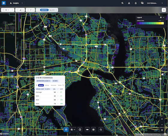
Collision Index: Proactive Traffic Safety Powered by AI
Communities now have another layer of road safety thanks to Urban SDK’s Collision Index
University of Florida Transportation Institute Partners with Urban SDK to Expand I-STREET Program
Urban SDK and the University of Florida have partnered to expand the university's I-STREET Program
Urban SDK Unveils Delay Data, Route-Building Capabilities
Urban SDK has released a new suite of products that further enhance its traffic management software.
Creating Safer Streets: Exploring the World of Traffic Calming
Innovative strategies and successful examples of traffic calming initiatives

Urban SDK Raises $65M Growth Round from Riverwood Capital to Scale AI-Powered System of Action for Local Governments, Transforming Public Safety and Service
Funding Accelerates Expansion of Geospatial AI Technology, Helping Cities Efficiently Respond to Critical Safety Concerns

Winter Mobility Planning: How Traffic & Road Data Helps Cold-Climate Cities
See how traffic data help cities optimize snow plow routes, allocate resources efficiently, and keep roads safe during winter storms.

Mobility Data for Climate Action: Measuring Sustainable Transportation Progress
Discover how data turns climate goals into measurable, sustainable transport progress.

How EV Infrastructure Planning Relies on Road and Traffic Data
Discover how planners use road and traffic data to design efficient EV charging networks.

Mobility Data Privacy: What City Agencies Need to Know in 2026
By 2026, cities must balance mobility data use and privacy. Learn key practices for geolocation data and complying with new privacy laws.

City Traffic Dashboards: Tips for Displaying Mobility Data
Learn how to design city traffic dashboards that display mobility data clearly for smarter urban planning

How to Use Road Segment Data to Prioritize Infrastructure Investments
How urban planners use detailed road segment data to prioritize infrastructure investments and make data-driven repair decisions.

Traffic Data for Freight & Logistics: Key Metrics for Urban Planners
Essential metrics urban planners must track to manage freight flows, curb congestion and optimize city logistics

Improving Road Safety with V2X: How Connected Cars Prevent Crashes
See how V2X technology helps connected cars prevent crashes with real-time alerts, collision avoidance, and pedestrian safety features.
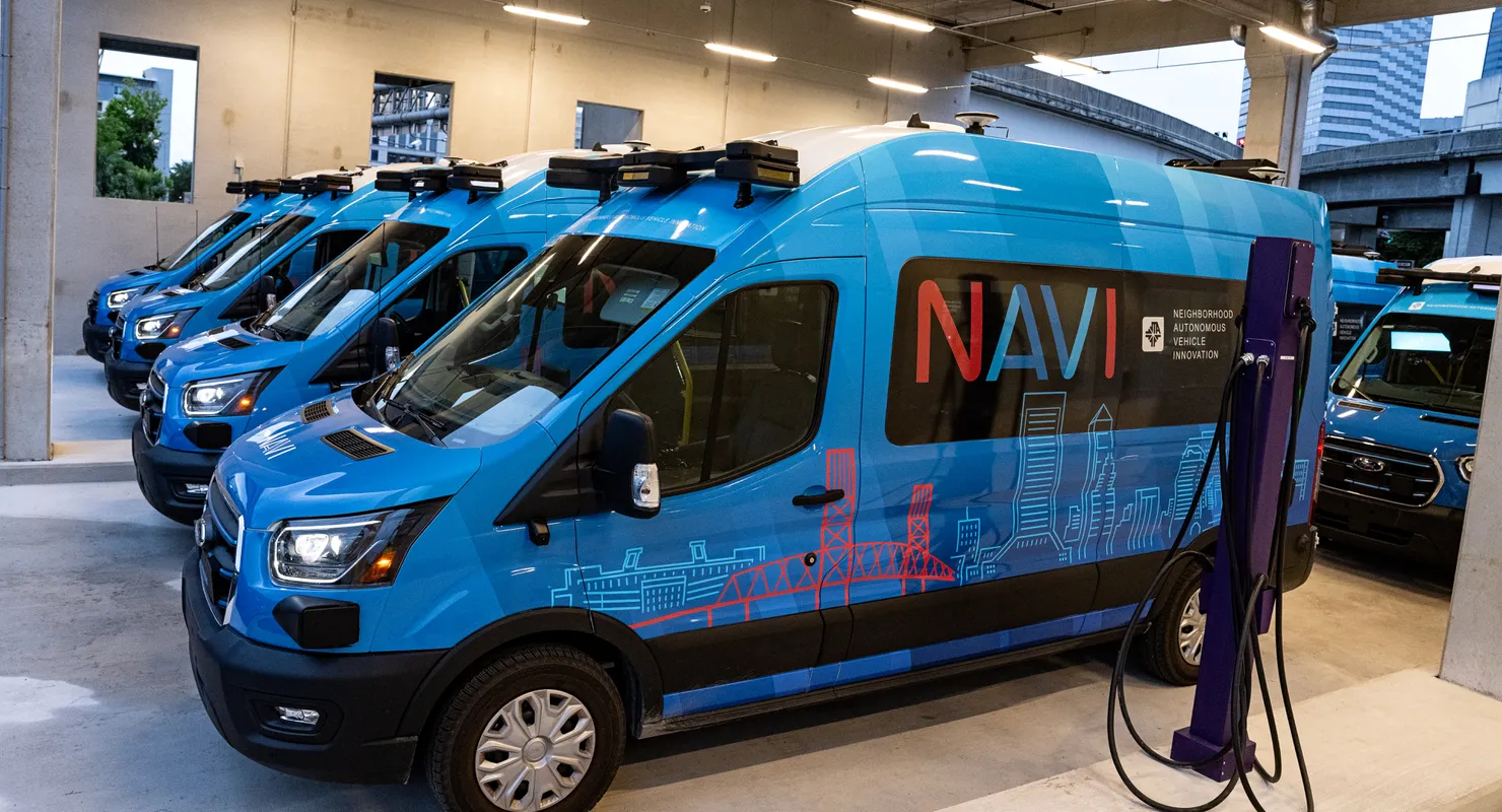
Synop, Urban SDK, and Miller Electric Company Enable Jacksonville’s Groundbreaking Autonomous EV Shuttles & Charging Hub
This deployment supports one of the first and largest public-sector autonomous shuttle projects in the United States

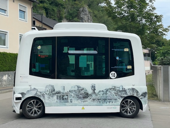
The Future of Self-Driving Car Legislation: What to Expect
Learn how agencies can prepare for the next decade of AV regulation

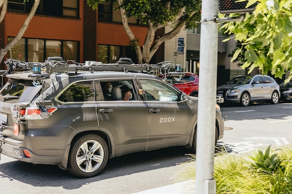
Preparing Cities for Autonomous Vehicles: Policy, Safety, and Infrastructure
Cities can prepare for self-driving cars with smarter infrastructure, traffic data, and safety analytics
Safety and Liability: Key Challenges in Regulating Self-Driving Cars
Learn how governments and insurers are shaping the future of AV regulation.
How Different Countries are Regulating Autonomous Vehicles
From Europe’s unified framework to Asia’s rapid pilots and the U.S.’s state-driven rules, explore the global landscape of AV regulations.
The Current State of Self-Driving Car Regulations in the U.S.
Learn how federal guidelines, state laws, and new bills in 2025 are shaping the future of autonomous vehicles.
Transit‑Oriented Development: Using Data to Plan U.S. Cities around Public Transportation
Cities are planning transit-oriented development using mobility data, ridership insights, and performance metrics for smarter growth.

Optimizing Curbside Management: Dynamic Pricing and Analytics for Parking and Loading Zones
Real-time data, dynamic pricing, and smart curbside analytics helps cities manage parking, loading zones, and curb access

AI‑Powered Urban Mobility Forecasting: Adapting City Transportation to Post‑Pandemic Trends
Traffic data is helping cities adapt transit and traffic planning to post-pandemic travel patterns, hybrid work shifts, and real-time demand

Mobility Equity in U.S. Cities: Using Data to Improve Accessible Transit for All
By using Geospatial AI and data, cities and counties can forecast road damage, save costs, and prevent disruptions.
Designing Safe Micro-Mobility Lanes: Using Data for Infrastructure Planning
Exploring how cities use data to design safer, more accessible micro-mobility lanes

AI and Road Maintenance: Minimizing Costs and Disruptions in City Streets
Cities can use AI and data to forecast road damage, save costs, and prevent disruptions

How U.S. Cities Can Use Data for Congestion Pricing
Using data to power smarter congestion pricing in U.S. cities.

Top 10 Road Attributes Every City Should Track in 2025
Discover the 10 most important road attributes cities must monitor in 2025—from lane width to crash risk.
.jpg)
Urban SDK vs. Manual Surveys: Time and Accuracy Gains for Transportation Departments
Urban SDK helps organizations diagnose roadways faster and more accurately by using AI, satellite imagery, and connected vehicle data.

How to Use Roadway Segmentation Data for Better Asset Management
How roadway segmentation data helps cities manage assets better—using AI and GIS to prioritize repairs and streamline budgets

3D Road Geometry Mapping: Why It Matters for Future Infrastructure Projects
How 3D road geometry mapping with AI and satellite imagery helps cities plan smarter, faster, and more accurate infrastructure projects

From Manual Surveys to AI Models: The Evolution of Roadway Data Collection
Exploring how AI and satellite imagery are transforming roadway data collection.

Streamlining Parking Inventory Collection with Geospatial AI
Using geospatial AI to aid in parking inventory collection saves time and imrpoves accuracy for city planners and transportation teams

The Importance of Accurate Road Width and Lane Measurements in Smart City Projects
In an era where transportation infrastructure evolves rapidly and public expectations are higher than ever, we need a better way

A Smarter Way to Inventory Sidewalks and Bike Lanes Across Cities
AI and satellite data can inventory sidewalks and bike lanes faster and more accurately than traditional methods

How Satellite Imagery Transforms the Way Cities Collect Road Data
Satellite imagery and AI to help cities map, monitor, and manage road networks faster and more efficiently

Why AI-Powered Roadway Inventories Are the Future of Urban Planning
How AI and geospatial data are supplementing manual road surveys

How Accurate Are AI-Generated Road Risk Scores for City Planning?
Evaluating the accuracy and effectiveness of AI-generated road risk scores

How Cities Use Risk Scores to Prioritize Safer Roads and Infrastructure Projects
Evaluating how risk scored can help cities prioritize safer roads in a community.

AI Solutions for Local Governments in 2025: Building Smarter, Safer, and More Connected Cities
How AI is powering smarter cities and transforming urban governance
The Encyclopedia of Transportation Planning Measures
Complete encyclopedia of transportation planning measures and calculations

New Tools from Urban SDK: Custom Boundaries, Enhanced Time Filters
Urban SDK has released a new set of features that provide organizations a greater ability to analyze their roadways.

University of Florida Transportation Institute Partners with Urban SDK to Expand I-STREET Program
Urban SDK and the University of Florida have partnered to expand the university's I-STREET Program

Urban SDK Partners with Fate, Texas to Foster Smart Growth
Fate, Texas enlists Urban SDK to help with continued population boom.

Urban SDK Unveils Delay Data, Route-Building Capabilities
Urban SDK has released a new suite of products that further enhance its traffic management software.

Tulare County to Use Urban SDK Traffic Data for Transportation Model
Urban SDK to provide Tulare County wiht traffic management software and traffic data for transportation model

Mobility Hub Study in Thunder Bay, Ontario
How Urban SDK was used to create a comprehensive precinct plan that is transit-oriented, walkable, safe, diverse, and practical.

Trip Analysis in Bradenton, Florida
Using Urban SDK to track special event trip distribution data during weekdays and weekends, as well as game days and non-game days.

West Florida Travel Distribution
Monitoring trip distribution through the Florida cities of Tallahassee, Jacksonville, Tampa, and Orlando

State of Florida Travel Study
Analysis to understand travel patterns in high-growth areas in Florida

Hurricane Ian Evacuation Analysis
Evaluation of evacuation trends prior to and Hurricane Ian's landfall in September 2022

Kentucky Transportation Cabinet Performance Reporting Operations
How Kentucky's Transportation Cabinet leverages Urban SDK for immediate access to data and reporting resources

Trip Distribution Study in Bartow, Georgia
How Cartersville-Bartow MPO use Urban SDK's data and reporting platform to understand trip distribution in their region.
Get 30 days free
traffic data in any city
See just how quick and easy it is to identify speeding, address complaints, and deploy officers.
Request access
